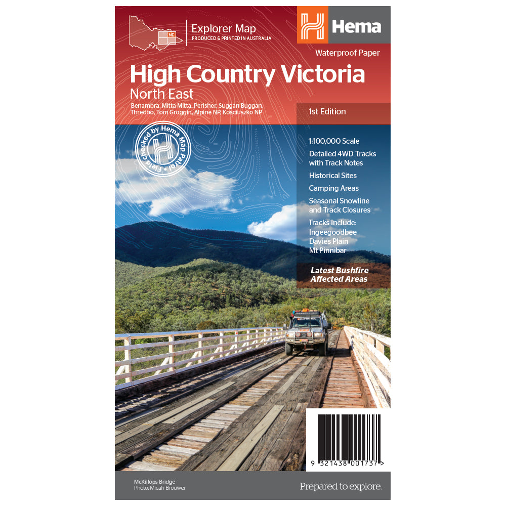

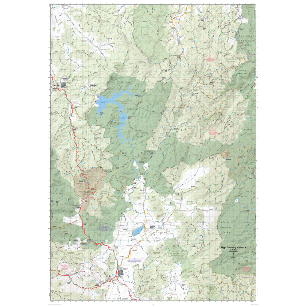

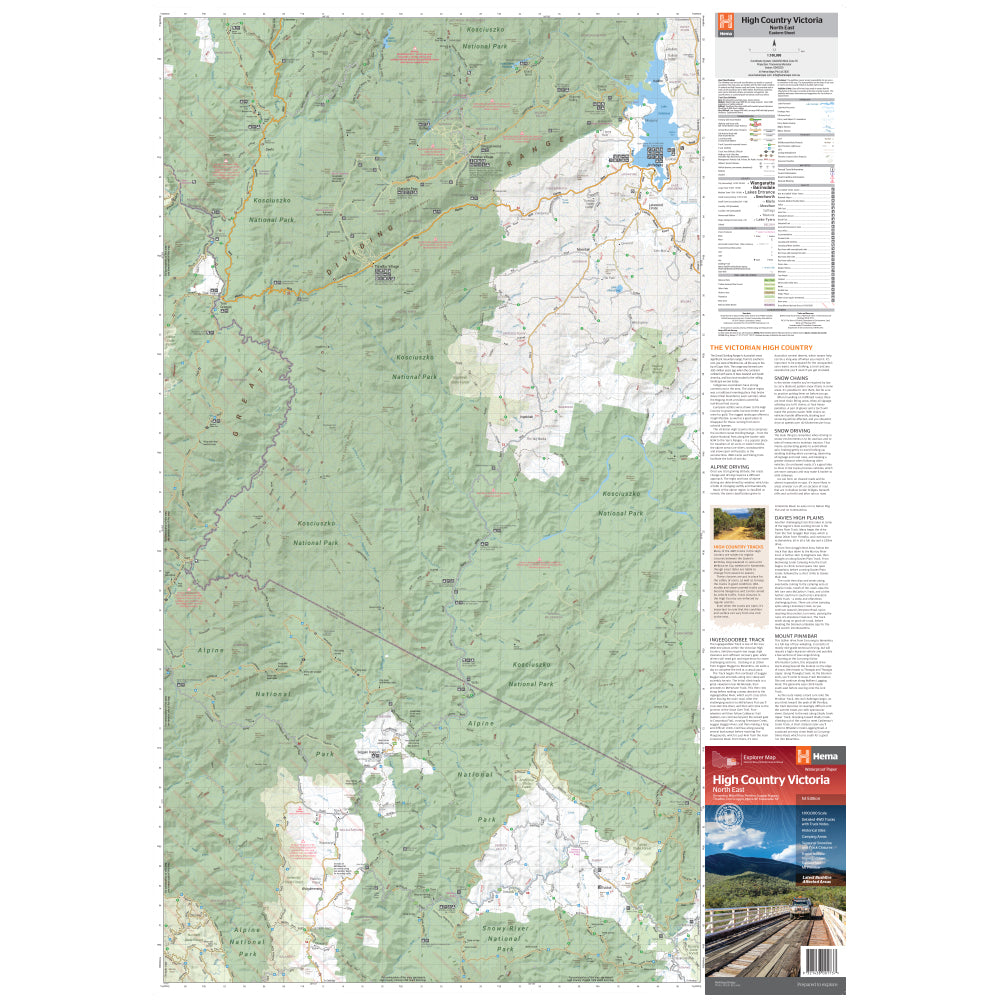

This map is part of Hema's new Victorian High Country Map Series and covers the Northern Borderlands Area. It overlooks the ranges that border Victoria and New South Wales from Omeo to Jindabyne, including such destinations as Benabra, Perisher, Tom Groggin, Thredbo, and Kosciuszko National Park. Printed on durable waterproof paper, this map features Hema's iconic mapping and extensive points of interest.
Featuring roads and 4WD tracks field-checked by the Hema Map Patrol for superior accuracy. It combines Hema’s entire database of roads and 4WD tracks with touring points of interest and topographic information. Also included are seasonal track closures, camping areas, old townsites, huts, accommodation, and distances. It is a premier destination for four-wheel driving, hiking, and outdoor recreation of all sorts.

We stock the full Weber BBQ range including the New Premium Weber Q's, the Genesis, Genesis Smart, Spirit Smart, & Spirit II Ranges, the classic Charcoal Kettles, the all new SmokeFire Pellet Barbecues, and a full range of accessories for everything Weber!

One of Australia's biggest camping and outdoor brands, you'll struggle to find a campground or market in Australia without an OZtrail Gazebo in sight! Check out the range of OZtrail gear below including the new Fast Frame tent range, and of course the classic OZtrail 3 metre Gazebo!

We stock a large range of Sea to Summit lightweight gear - everything from Dry Bags and Microfibre towels to Collapsible Bowls and Ultralight Pillows. Their lightweight yet durable products are perfect for any hiker, trekker, camper, tourer or traveller.
